


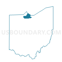
032 ERIE 1, Ottawa County, Ohio
About
Outline

Summary
| Unique Area Identifier | 650858 |
| Name | 032 ERIE 1 |
| County | Ottawa County |
| State | Ohio |
| Area (square miles) | 13.64 |
| Land Area (square miles) | 12.24 |
| Water Area (square miles) | 1.41 |
| % of Land Area | 89.67 |
| % of Water Area | 10.33 |
| Latitude of the Internal Point | 41.53125170 |
| Longtitude of the Internal Point | -83.02782700 |
Maps


Graphs
Select a template below for downloading or customizing gragh for 032 ERIE 1, Ottawa County, Ohio


Neighbors
Neighoring Voting District (by Name) Neighboring Voting District on the Map
- 003 PORT CLINTON 2A, Ottawa County, OH
- 013 BAY 1, Ottawa County, OH
- 017 CARROLL 1, Ottawa County, OH
- 018 CARROLL 2, Ottawa County, OH
- 046 SALEM 4, Ottawa County, OH
- 047 SALEM 5, Ottawa County, OH
- WATER, Ottawa County, OH
Top 10 Neighboring County Subdivision (by Population) Neighboring County Subdivision on the Map
- Port Clinton city, Ottawa County, OH (6,056)
- Salem township, Ottawa County, OH (5,371)
- Carroll township, Ottawa County, OH (2,135)
- Bay township, Ottawa County, OH (1,458)
- Erie township, Ottawa County, OH (1,221)
Top 10 Neighboring Place (by Population) Neighboring Place on the Map
Top 10 Neighboring Unified School District (by Population) Neighboring Unified School District on the Map
- Port Clinton City School District, OH (13,596)
- Benton-Carroll-Salem Local School District, OH (10,225)
- School District Not Defined (Water), OH (4)
Top 10 Neighboring State Legislative District Lower Chamber (by Population) Neighboring State Legislative District Lower Chamber on the Map
Top 10 Neighboring State Legislative District Upper Chamber (by Population) Neighboring State Legislative District Upper Chamber on the Map
Top 10 Neighboring 111th Congressional District (by Population) Neighboring 111th Congressional District on the Map
Top 10 Neighboring Census Tract (by Population) Neighboring Census Tract on the Map
- Census Tract 508, Ottawa County, OH (4,056)
- Census Tract 512, Ottawa County, OH (3,520)
- Census Tract 506, Ottawa County, OH (3,293)